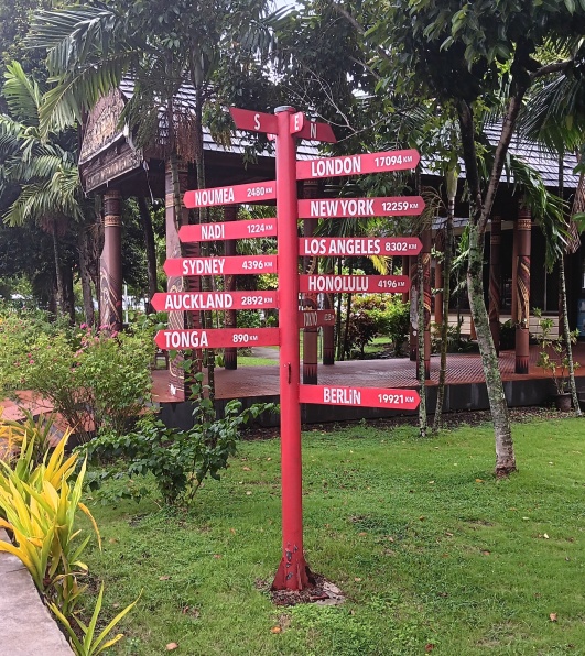
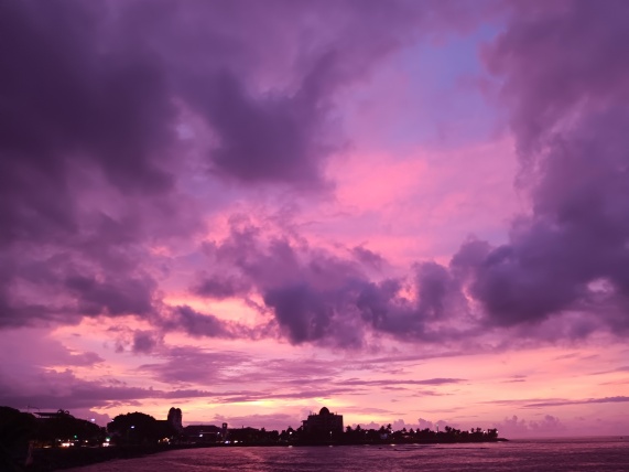
137 years ago this past week, some truly crazy stuff went down here in Apia Bay.
It was the Ides of March, 1889. Out in the little reef-hemmed harbor, seven ironclad warships from three adversarial world powers clogged the scant available anchorage of this infinitesimally unimportant archipelago. Each sat humming on low-steam, awaiting imminent hostilities. In the woods behind town, several thousand Samoan warriors—who were sort-of aligned with two of the powers—also sat ready.
The weather, characteristically fine during the preceding months, had characteristically grown turbulent through February. Now it was March, the riskiest of the twelve. On this particular day, March 15th, wind had begun to blow from the north, straight into the harbor.
By 2 pm the glass fell to 29.11. This was the moment when every boat should have left, as each captain of each boat more-then-well knew. That’s why they had barometers. But USA Commander Kimberley instead kept his three warships— the Nipsic, the Trenton, and the Vandalia—in place. The latter two, being the latest arrivals, couldn’t even fit into the harbor and had to park out in the entrance bottleneck.
Doggedly, his German adversary followed suit and kept his Olga, Eber, and Adler also in place.
What could the British commander of the Calliope do but stay as well, and await the ensuing fireworks?
Such is the testosterone of war.
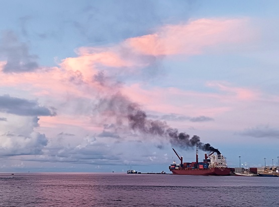
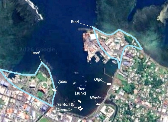
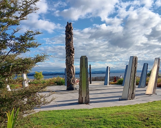
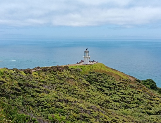
Before we go further, let’s have a look at the harbor. Here we have a smallish bay into which two streams discharge, their fresh water bursting a reef and creating a narrow channel through what is otherwise shallow coral and a barrier to open sea.
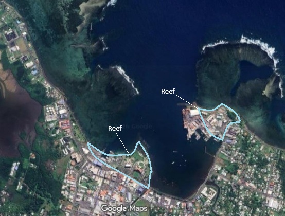
Nowadays things look a bit different than back then, thanks to some landfilling—or reef-filling, rather—that was done several decades ago. But the extremely snug geometry, from a shipping standpoint, remains the same.
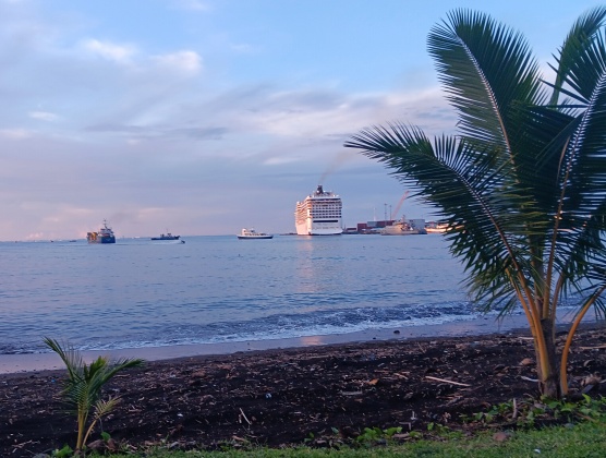
It’s even more snug now that ships have gotten a whole lot bigger. Many evenings I have sat on the bay, and watched a single container ship ease its way into the slot of deep-enough water, then get “scootched” sideways by tugboats to mate up with the wharf that has been constructed atop of what was formerly all reef. And several evenings I have witnessed a cruise ship (of which we get one or two per month) toot its horn, slowly pull away sideways, and then shift course and head out to sea, where a container ship usually looms waiting to take its place. Here in Apia we can accommodate either one container ship or one cruise ship, but not both.
So, what were the seven warships doing here in 1889? Was Samoa really that important? The answer is: of course it wasn’t. But you couldn’t tell that to the parties involved.
To back up a little: both Britain and the USA had consuls in Apia by the1840s, and for a time they kept their non-significance well in perspective. Then, in the later-1800s, Germany belatedly got into the colony biz despite the solid reluctance of Otto von Bismarck. By then it was decidedly slim pickings on planet Earth when it came to lands still available to exploit. Eager, inexperienced, itching for empire, these Germans saw in microscopic Samoa something that could maybe become their Raj, their India. Here they could become imperial masters. Here they would get rich on coconuts. And in due course, what was known as “the German firm” got busy and got about 10,000 acres under cultivation—whoopee—and proceeded to monopolize copra (coconut) and cacao, bringing in dark-skinned slave labor from the Solomons to help.
The Americans and British coexisted, disgruntledly. Apia, a neutral zone, became, in the words of eventual resident Robert Louis Stevenson, “the seat of political sickness of Samoa…like a bone between dogs, each growling, each clutching his own end.” In Stevenson’s words, the German firm, “the true center of the trouble”, had the most money sunk and so was “prepared to oppress rival firms, overthrow inconvenient monarchs, and let loose the dogs of war.”
By 1881 the Germans decided they needed a more efficient native government, one they delusionally felt they could coerce to collect taxes, build roads, punish crime, and quell rebellion. They also wanted to extend their own provinces while curtailing those of their rivals. Basically, they wanted a “King of Samoa” whom they could target and harass to deliver these items.
Never mind that taxation was such a totally bizarre idea to Samoans that it never, ever, could have worked. And never mind that there was no such thing as King of Samoa. For thousands of years, there had been five separate kingships in Samoa, but not always five separate kings. One man, by holding all five royal names, might become king of all parts of Samoa, but there was no such thing as a kingship of all of Samoa. Also, if someone held only one of the names, he’d be just as much of a sovereign as the other four. In 1881, the five names were split between three people.
Thus the 1880s proceeded in a very messed-up fashion with the Germans anointing one “king”, then another, neither able to deliver what was wanted, while, with an increasingly heavy hand, they steadily pissed off other Samoans as well as the Brits and Americans who sympathized with and armed these Samoans. Finally outright war broke out between opposing Samoan groups, backed by their respective powers, in August of 1888. Long story short, the Germans overreacted ineptly and inanely, got their own soldiers involved, and got a bunch of said soldiers slaughtered on a beach east of Apia in December. It could have been much worse; the Samoan “rebels” went lenient on them.
This brings us to the Ides of March, 1889, with seven warships steaming in the bay.
Germany, despite stern reprobation from Bismarck and clear orders to back off, seethed to avenge its fallen boys.
Americans, for their part, were furious about the destruction of an American flag, German imposition of martial law, and attempts to try an American in a German military court. News of this reached the USA Senate floor, where it caused outrage. Newspaper headlines screamed. German immigrants in the States disowned their mother country. Young German and American men came to blows in the streets of Honolulu.
More American ships arrived. And, at least in Apia Harbor, the USA and Germany arrived at the brink of war.
Then Mother Nature arrived.
Night closed black on March 15th, rain falling in sheets. By midnight it was a gale.
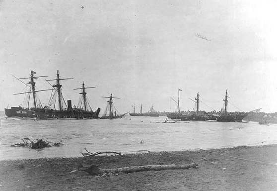
At daybreak, March 16th, hurricane-force winds blew straight into the harbor mouth and tossed the warships around like toys.
The Eber was already gone, having hit coral twice and sunk stern-down. Of 80 men, four were cast alive onto the beach; the remaining 70-odd were washed out to sea by the voluminous creek water undertow, and their bodies strewn naked along the northern seaboard.
The Trenton maintained her position in the harbor neck. The remaining five tossed around and collided, damaging each other.
At 7 am the Nipsic, smokestack-less due to a collision and barely producing any steam, lucked out and beached on sand. Most of the crew hopped off and reached safety; Samoans assisted.
By 8 am it was the Adler’s turn. Slipping her moorings, she heaved and careened and landed on top of the bay’s western reef, where she lay broken on her side—for years. Many were injured, many were thrown into the water, and about 20 were dead. Survivors crept back on and spent a miserable day and night.
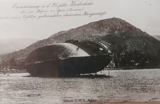
Nowadays this area is landfilled and home to a lovely park, some government buildings, and a cultural center. As best I can tell, the Adler’s resting place was right next to where a skateboard park now resides, where no one ever skateboards, but where children delight in running around on and sliding down the appurtenances.
Now there were three warships left in the harbor proper, steaming on their moorings and crashing into each other: the Calliope, the Olga, and the Vandalia.
The British Calliope, heaviest of the three and in the most danger, made a break for it. Running full steam and pointed towards the exit, at first she barely budged. Then she gradually drew forward, narrowly steering around the now-rudderless Trenton on one side, coral on the other, before pointing seaward again and disappearing into the mist. As she passed a cheer went up from the beleaguered Americans on the Trenton. Later, in an official British correspondence, a thankful “blood is thicker than water” comment was made.
By mid-morning the Vandalia tried to beach alongside the Nipsic. She struck coral, swung to starboard, and began to fill and settle. Lives were lost trying in vain to get a line to shore, and the captain was swept to sea. What survivors there were climbed to the tops and took refuge.
At about 3 pm, the Trenton parted her cables. Rudderless, she drifted into the inner basin. The Olga tried to avoid her, but at about 4 pm the ships crashed, whereupon the captain of the Olga released her moorings and successfully beached nearby.
All that was left for the Trenton to do was drift the rest of the way in and crash into the poor half-sunk Vandalia. Fortunately this happened in slow motion, and the crews were able to tie the ships together and wait out the rest of the day and night. 43 died on the Vandalia; only one on the Trenton.
In the words of Robert Louis Stevenson:
“The morning of the 17th displayed a scene of devastation rarely equaled: the Adler high and dry, the Olga and Nipsic beached, the Trenton partly piled on the Vandalia and herself sunk to gun-deck; no sail afloat; and the beach heaped high with the debris of ships and the wreck of mountain forests.”
Needless to say, the war got called off—that particular war, anyway.
Stevenson goes on:
“Thus, in what seemed the very article of war, and within the duration of a single day, the sword-arm of each of two angry Powers was broken; their formidable ships reduced to junk; their disciplined hundreds to a horde of castaways…Both paused aghast; both had time to recognize that not the whole Samoan Archipelago was worth the loss in men and costly ships already suffered. The so-called hurricane of March 16th made thus a marking epoch in world history…”
But not very much epoch-ly marking, if you ask me.
For example, there’s a good chance you’ve never heard this story up until now. And though this event served as a good example of what can go wrong when ego, greed, and national pride eclipse necessity, it certainly never blunted the aspirations of any imperialist power. Just made them pay a little more attention to the weather.
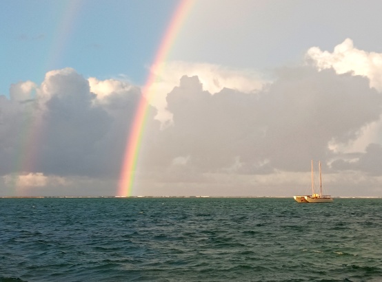
By the way, the Ides of March came and went this year with a gentle trade breeze, some refreshing washes of rain, and magnificent evening rainbows out beyond the reefs. It’s been sunny and lovely all week.
Sitting on the bay in the evenings, you might find it hard to imagine a tempest could blow in, like that one did 137 years ago.
But don’t let Mother Nature fool you.
First, a little bit of old business. A couple months ago we traced the journey of the beloved cacao plant of Samoa, from its birthplace in the upper Amazon, through Mexico, the Philippines, and Sri Lanka, here to Samoa. And I posed the unanswered question, “Why did cacao become part and parcel to the culture here, but almost nowhere else in Asia-Pacific?” Foolishly, I’d blurted this out without first checking with my friend and confidant, Marissa.
Marissa was born, and grew up, on Luzon in the Philippines. When I eventually followed up with her, this is what she said:
“In the province of Cagayan, cacao was big when I was growing up. Our backyard had coffee, cacao, mangoes, bananas, a cherry-like fruit, and a green berry-like fruit that I don’t think has an English name. I used to climb that tree a lot. We made our chocolate drinks from the fruits of our cacao. They were ground up and made into balls. The drink doesn’t have a lot of water. Instead, carabao milk was used as the creamer. Brown granulated sugar to sweeten. The drink is not very smooth and you can feel the granules as you sip the hot drink. Obviously, they use either evaporated or condensed milk now. But to answer your question, yes, cacao is still big in Tuguegarao. And it’s grown all over Cagayan to this day.”
So there you have it.
Aside from local cacao, what are the best things to eat and drink in Samoa, thousands of miles from everywhere?
Naturally it’s best to go with what’s fresh and local. And here you can run into problems, because (a) Samoans are not very good about eating their vegetables, and (b) the diet is somewhat bereft of things that are green.
Pumpkin is abundant and cheap year-round; a wonderful health-filled staple. In particular the cucurbita moschata species thrives here, which, like cacao, originated in the warm wet regions of northern South America.
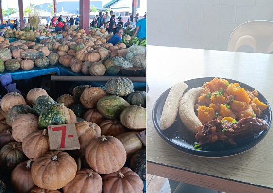
But this pumpkin’s meat is orange. What about something green?
There are several options. Among the most awesome are the gigantic tropical avocados. I’ve mentioned these before. These are the West Indian race of avocado (likely originated in Colombia, though this is unclear): one to three pounds in weight, creamy, and lower in oil than your dinky Hass.
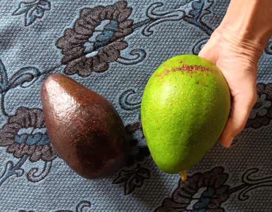
Do not be shy when applying this to your toast. Go ahead, slather it on! Half an inch thick, or more! And sprinkle generously with salt for some breakfast heaven. They say peak avocado season is September to December here, but as of yesterday morning the market was still full of them, though prices have crept up from seventy cents to a little over a buck each. I’ll go through withdrawals if and when they become gone.
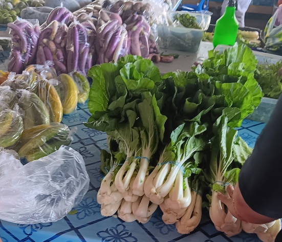
Do you get excited about cabbage? I don’t. But it grows here, and you can eat it if you want. In my opinion it doesn’t qualify as something green after being cooked. Bok choy is also available, and it isn’t cheap, but it has green leaves (that shrivel a whole lot when steamed). Locally-grown watercress is also available.
There is a popular dish that is fried eggplant stew, usually containing lamb, which is sort of green. This is heavy food of the comfort variety, a standard component of Samoan Sunday afternoon feasts, eaten between attending church and going back to church. It tastes okay (hold the church), but does not give you much of an “I’ve eaten my veggies” feeling.
Better results are achieved with yardlong green beans, also known as asparagus beans.
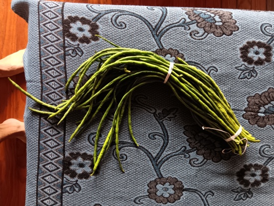
These robust pods, originally from Southern Asia or maybe tropical Africa, are actually more like half a yard long. You can buy a big bunch for a few dollars, cut them into bite-size lengths, and do anything you normally do with green beans. Stir fries and steaming work great.
And then we have the wonderful taro leaf: the epitome of cheap, local, and hugely nutritious. Taro has a long history in Samoa; likely it was something the original settlers brought with them 3,500 years ago.
This is a marvelous leaf for a spinach lover, but it does come with a big caveat: the raw leaves are poisonous. You might need to wear gloves to handle them, and cooking is absolutely necessary in order to eliminate high levels of oxalates, which can cause severe itching and throat inflammation that lasts for days in some people.
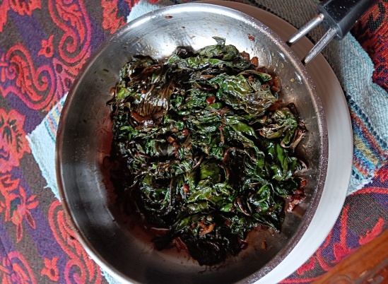
Samoans prefer to bake their taro leaves in Hershey’s kiss-like foil twists, in which the leaves are wrapped around a central glob of coconut cream.
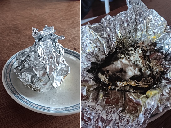
Perhaps the rich oily cream helps take the edge off, but the result is a dish less like a vegetable and more like a dessert. Your body signals you to eat just a little, not a lot, and the feeling afterwards is decidedly the opposite of a crisp, healthy, I’ve-eaten-a-vegetable feeling.
I love to buy a few wads of taro leaves in Fugalei Market for next to nothing, and stir-fry them up with garlic and soy sauce, adding a touch of sugar and fish sauce. Delicious! The first time I did this, however, I did not get them separated and cooked-through enough, and was met with a painful stabbing sensation in my mouth and throat. It wasn’t a big deal though, and now I know. My husband Dewey, on the other hand, is much more sensitive to taro leaf and keeps away from it entirely.
“Okay,” you might be saying by now. “Is that all? Green stuff from Asia, from South America? Wasn’t there anything already here, that was green to eat, that didn’t need to be brought? Or was it just taro, taro, taro for Samoans, for thousands of years?”
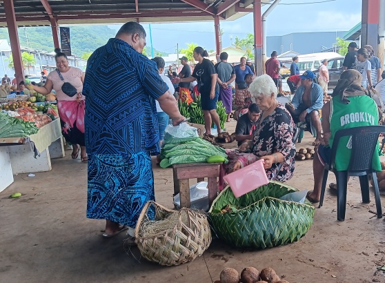
I pondered this as I walked through Fugalei Market recently. Finally, I noticed an answer that had been staring me in the face all along.
Of course! Seaweed.
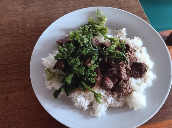
In this case, a species known as “sea grapes”, called limu fuafua.
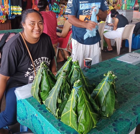
First off, the packaging is gorgeous and totally fun: a bright-green pop-open box fabricated of moisture-retaining breadfruit leaves, which also effect gentle cooling and ventilation. Inside is the main treasure: a mound of shiny wet sea polyps which are delicious when eaten raw.
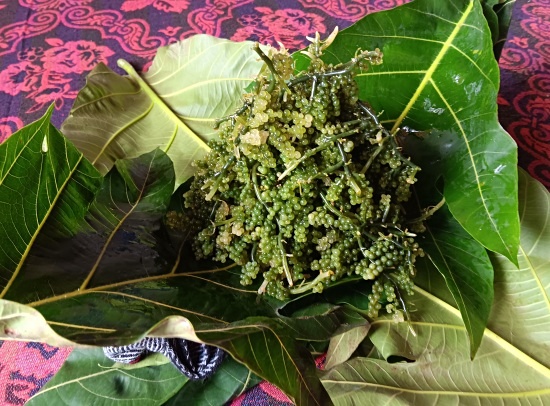
Salty and of-the-sea, they are a bit strong as a standalone snack, but great when mixed with other things. In fact, they are dynamite when added to just about any main dish, as a garnish. The joy of moderately-mixed-in limu is the texture-flavor combo you experience when the yummy salty-sea vesicles burst in your mouth like easily-popped bubble-wrap. What’s more, they bring with them doses of omega 3, vitamin C, iron, calcium, and antioxidants.
Limu occurs naturally right here in Upolu, mostly on the northwest shores, where it forms carpets in the shallows on both the outer and lagoon sides of the reefs. What a goldmine, I mean, green-mine!
After bagging my limu for fridge storage (it does have a limited shelf life), my eyes fell upon the greenest green of them all: the leftover breadfruit packaging leaves.
And I wondered: Are breadfruit leaves edible? If so, that would make them a nearly-indigenous green thing to eat in Samoa! (Breadfruit likely originated in New Guinea.) Google’s AI said yes, breadfruit leaves are edible. So, the only thing left to do was try. I cut out the stems, collared-greens-style, and put them in a pot on slow boil.
Six hours later, the verdict is, sadly, that breadfruit tree leaves are not very edible. Their glorious Tahiti-green has faded to puke-ish, the texture has become leathery, the flavor bitter. You’re better off making tea with them, which is what most people do, which is what I basically did (a six-hour version). Either that, or apply the boiled leaves to skin rashes and burns, as a poultice.
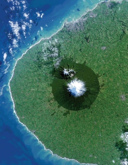
A curious feature appears when you view New Zealand from space. Within a lobe of the western coast of the North Island, a near-perfect circular disc of deep green jumps out at you, centered on a volcanic peak, backed by the paler green of surrounding farmland.
The volcano is Taranaki, now named Taranaki Maunga, formerly also known as Mount Egmont. At 2,518 meters (8,261 feet), it is the country’s second highest volcano. The deep green disc is old-growth forest that became protected way back in 1881, when the area within a six-mile radius of the summit was established as a forest preserve, and everything else got burned and cleared. In 1900 this disc became Egmont National Park, the country’s second national park. Much more recently, on April 1, 2025, the park’s name was changed to Te-Papa-Kura-o-Taranaki, and the mountain itself became a legal person. More on this in a moment.
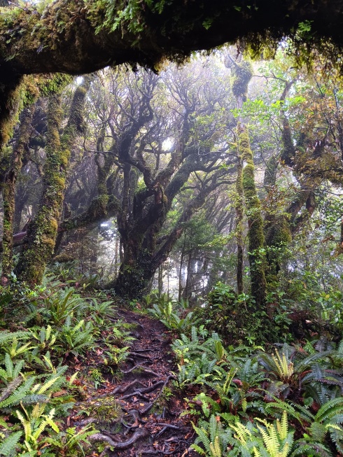
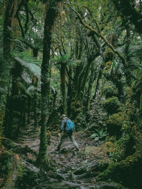
The old-growth forest is utterly magical and mesmerizing, I can attest, having trekked 25 kilometers through it in a drizzle earlier this month (New Zealand being an affordable and accessible travel destination from home in Samoa). Never before had I experienced anything quite like this forest, and I got hypnotized in its vibe. Rich soil and lots of rain mean the whole region used to be like this; indeed, when Captain Cook visited in 1770 he noted a snow-capped peak with surroundings “clothed in wood and verdure.” Now all that remains of the verdure is the six-mile disc.
Outside the park boundary, what you see is intensive dairy farming. The region is home to about half a million milking cows; nearly 10% of the country’s herd cranks out its methane burps and other effluents here. Also present is the Fonterra’s Whareroa facility, the world’s largest milk ingredients factory by annual output, cranking out milk, milk powder, butter, casein, whey, and cheese. China is the number one export market.
The dairy thing is relatively new to New Zealand. When I first visited, in 1991, the reputation was still mostly about sheep. A common thing to say back then was that there were something like four sheep for every New Zealand person.
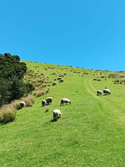
Cows, which are much harder on the environment, have since displaced sheep to a significant extent, to the degree that the country’s cow-to-person ratio is now nearly one-to-one. In the Taranaki Region, the ratio is more like five-to-one.
Dairy really got going here only after 1988, when damage from nearby-passing Cyclone Bola motivated many Taranaki farmers to switch from crops to cows. Then, in 2001, Parliament passed a dairy industry restructuring act which resulted in the two largest cooperatives merging with the New Zealand Dairy Board to create Fonterra, New Zealand’s largest company.
This is not to say that, had you seen the Taranaki Region from space 100 years ago, you wouldn’t have noticed the six-mile disc. Long before dairy, the slash and burn had commenced, and farms reached right up to the park boundary. A big boost happened back in 1865, when the colonizing government confiscated much of the region from local Māori people to provide farmland for military settlers.
I have a feeling what you expect me to do next: continue in language deeply reverential of the Māori and their eons-old connection with and stewardship of New Zealand’s natural world and each other, while summarizing atrocities of later-arriving Europeans. And this is exactly what I am not going to do.
Because that would be selective and creative storytelling that obscures and evades what actually happened. Throughout this trip to New Zealand, I noticed a pattern: a consistent slanting of the narrative, which skewed things Māori in a reverential light while being much more critical of other human beings.
I’ll give some examples below, but first let’s consider the time frame. You could be forgiven for supposing, based solely on the breadth and intricacy of Māori mythology, in which so many things are considered sacred, that the Māori have been in New Zealand for thousands of years. Of course, we know this is not true. The truth is that they arrived here a scant few hundred years prior to Europeans—a split second, essentially, in human history time frame terms. Within this very short period they did a lot of things, in addition to concocting an elaborate mythology.
Exact timing is still up to debate, but around the year 1300, people began arriving in canoes from much, much smaller islands in eastern Polynesia, ones that were necessarily resource-constrained, with all the warlike culture associated with scarcity deeply ingrained. New Zealand must have seemed utterly boundlessly bountiful to them at first, but within a half-dozen generations these people did what normal humans normally did and still do: formed tribes, burned forests, drove mass extinctions, and viciously fought each other over resources to the point of annihilation and genocide.
This information is well-established and very accessible to anyone who wants to study it to whatever level of detail. That’s not what I’m talking about here, when I criticize the narrative slant a person can casually receive while hanging out in modern New Zealand. What I’m talking about might best be illuminated by a few examples.
Take the moa, the legendary extinct, giant flightless birds of New Zealand, for example. Their forebears were present when New Zealand broke away from the Gondwana supercontinent eighty million years ago, and went on to survive at least thirty ice ages. Eleven species thrived at the time the first Polynesian canoe scraped sand, but they barely lasted for a hundred years after that, and were completely gone within two hundred years. It was one of the fastest extinctions in the history of the planet.
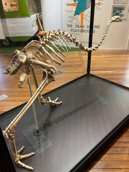
At the Moa Exhibit in the Taupo Museum, the placard mentions briefly that moa habitat was “diminished as Māori cut and burnt bush to plant crops and reduce surprise attacks from other tribes. The abundant bird life was a valuable food source and thus began the disintegration of many native species.” Then the text immediately pivots to the following spiel: Five hundred years later, Europeans arrived and continued to cut and burn the bush. They also drained the swamps and introduced possums, stoats, weasels, ferrets, rats, and hedgehogs. These predators faced no opposition or competition. Due to New Zealand’s isolation in the South Pacific, many birds had become ground dwellers, making them easy prey to the introduced species. The fight against these pests is far from over…
Huh? This is supposed to be the Moa Exhibit, talking about moa, which were gone shortly after the Māori arrived, before Europeans.
In other places, contradictions were jarring. Take the National Kiwi Hatchery outside of Rotorua for example (kiwi are nearly extinct in the wild, hence this hatchery). There, a placard reads, in large bold print at the top:
Māori have a special relationship with kiwi, in fact kiwi are a taonga (sacred) species. Traditionally, they are thought to be under the protection of Tāne Mahuta, god of the forest. As kiatiaki (guardians), Māori are protectors of our national icon.
Below, on the very same placard, in much smaller print, it reads:
Traditionally Māori hunted kiwi for meat, skin, and feathers. Dogs were sometimes used or nooses were set at the burrow entrances.
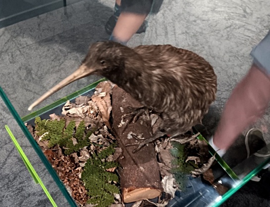
Hanging in the display case of this placard is a blanket made from kiwi feathers. “These cloaks aren’t just for everyone,” it advises. “They’re reserved only for chiefs” and said to carry the spirits of the birds they are “crafted from.”
Speaking of dress, have you ever seen a picture of a Māori person in traditional dress, holding a paddle made of pounamu (jade), or other stone material? Repeatedly, in museum exhibits and in the two cultural shows we attended, we were told that such displays are ceremonial and respectful, symbolizing authority and status.
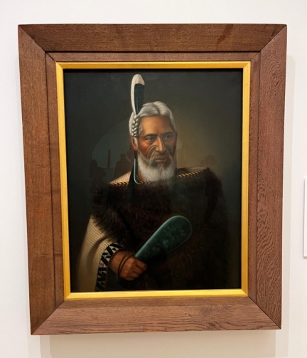
We were never told verbally, and only read in the fine print of museum exhibits, that the paddles were the lethal weapons of the Māori, the goal being to kill your opponent in close combat by going for the temple or juggler. Eventually men carried their paddles with them pretty much all of the time, even when taking a poo, because you never knew when an enemy would strike. Then the British came and introduced muskets, and the paddles, as weapons, went by the wayside. The Musket Wars of the 1800s ensued: a vicious cycle of Māori tribes purchasing muskets from the British in order to annihilate and enslave other Māori tribes, in order to plant more crops to sell to the British to buy more muskets.
Then there’s the abundant flowery language posted on signage in public spaces. Take this bit, from a café-qua-museum stop along the road to Cape Reinga (at the North Island’s northern tip), elaborating on wood used to make Māori canoes: Te Ara Whānui is our vision. It is the blueprint that sets a unified direction for the aspirations of Ngāti Kuri, underpinned by our history and the connections established by our ancestors…The name Te Ara Whānui refers to the many pathways of encounter that spread across the Far North. The pathways are drawn together by a waka (canoe)—a representation of our journey through time, and a reminder of the interconnection of all living things. The waka signifies the importance of our relationship and responsibilities to the natural world. It unifies and reminds us of the collective effort required to strengthen those elements that distinguish and determine our cultural identity and wellbeing.
What does that even mean?
Or this, from the top of a signboard at Aukland’s harbor: Te Ara Tukutuku is the Māori name used for waka (canoe) ramps to reflect how Māori used the original shoreline…It is also a metaphor for the binding of the land and sea—providing an elegant link between the domains of Tangaroa (the ocean) and Papatūānuku (Mother Earth)—and reflecting our vision for this space.
The signboard goes on to state, much less romantically, that in the past, the “entire precinct was utilized as a large scale fish processing plant. Waka were continuously dragged in and out of the water…The fish and sharks were scaled, gutted, and processed.”
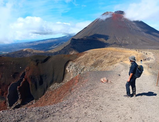
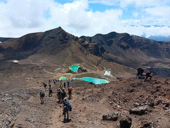
Two days after hiking Taranaki, we did the Tongariro Crossing, a stunning 20-kilometer trek across the volcano complex south of Lake Taupo.
Of course, we were informed that we needed to stay on the trail at all times, not because it was the right thing to do, but because the surrounding lands were considered sacred. By then I was getting tired of hearing this. The word “sacred” had started to smell funny to me, especially when applied to the Earth’s landforms, by humans who had arrived a few hundred years before other humans. Of course I was going to stay on the trail. I didn’t need the word “sacred” to police me (and by the way, the act of walking on this Earth is sacred to me; I firmly believe it is our shared birthright). By now the word “sacred”, as applied here, smacked of the typical control, separation, and “power-over” humans are seeking when they invent and perpetrate religions.
Back to Mount Taranaki: it’s probably a good thing the Māori consider it sacred, else we might not have the Six-Mile Disc! In Māori lore the mountain, like all North Island volcanoes, used to reside in the center of the island. There, Taranaki and Tongariro battled for the love of Pihanga, another volcano. Taranaki lost and headed west, eventually becoming petrified in its current location. Tongariro’s periodic eruptions are a warning to Taranaki not to return.
You are allowed to climb Taranaki, and many do. But you aren’t supposed to walk to the highest point on the crater rim because that act is considered offensive by Māori.
You may have heard that, this past April 1, the Six-Mile Disc got a new name. It is now called Te Papa-Kura-o-Taranaki, which means “the highly regarded and treasured lands of Taranaki”. Also at this time, the mountain became vested as a legal person. I’m not sure what that means; Wikipedia says it means the park owns itself. I’m skeptical.
In other good news, the Six-Mile Disc became eradicated of goats in 2022, several years after getting free of pigs (which were introduced by the Māori) and deer. It still has possums, hares, stoats, weasels, and ferrets; more than a thousand traps are in place, and we saw quite a few of these traps alongside the trail.
Part of the goal is to rebuild the park’s kiwi population. Progress is being made!